Nepal Flood Zone Faces New Threat From Landslide-Formed Lakes
Scientists warned that unstable debris dams could release additional floods after a destructive flow killed hundreds and devastated valleys in Nepal.
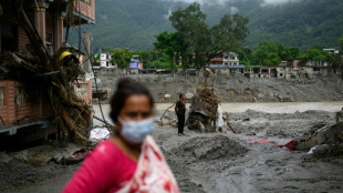
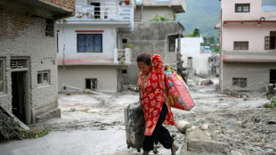
Residents and rescue workers in Nepal faced the risk of another flood on Friday after debris blocked upstream rivers and formed unstable dams. The warning followed a Wednesday torrent that overtopped buildings and destroyed hydropower plants, farms, solar facilities, roads and forests in narrow mountain valleys.
Government reports said 538 bodies had been recovered by Friday afternoon local time and nearly 1,000 people remained missing. Mud, water and debris traveled more than 60 miles into Rasuwa district and reached the Bhote Koshi and Trishuli river systems.
Sunil Tamang, a University of Canterbury doctoral student who studies rock glaciers and grew up in Syafru Besi, said photographs showed bare, mud-covered slopes where his village had stood. His parents and sister were safe in Kathmandu and an aunt and uncle survived because they happened to be at a shop on higher ground, but he did not know the fate of many relatives and friends.
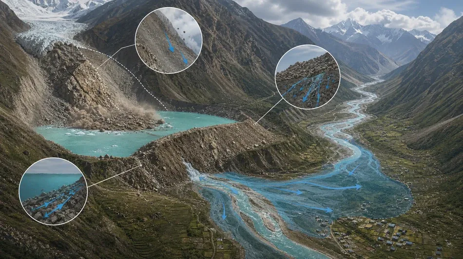
Satellite imagery indicated that the cascade began when ice and rock fell nearly 4,000 vertical feet from the northern side of Langtang Lirung, a peak of about 23,700 feet near the Chinese-controlled Tibetan border. Geomorphologist Dan Shugar said the images also showed a large new lake capable of bursting and threatening downstream communities and rescue teams.
Scientists said it was too early to determine the precise trigger. Research nevertheless shows that warming increases high-mountain hazards by melting glaciers and thawing permafrost that has stabilized slopes for tens of thousands of years. Similar landslides have caused major damage elsewhere in the Himalayas and in Switzerland. The same Nepalese valley flooded in 2025 after a glacial lake drained rapidly.
Glaciers on the other side of Langtang Lirung are among the most closely studied in the Himalayas. Research published in June found they had shrunk by more than 40 percent since 1815 and that the rate of loss had accelerated. Mountain areas above 4,000 meters are warming faster than the global average.
Jeff Da Costa of the University of Reading said reports of new barrier lakes were especially concerning because upstream conditions remained in motion. Close monitoring and prompt information-sharing between Nepal and China could provide more time for warnings. The temporary lakes can fill quickly and overwhelm the rubble that holds them, releasing another surge.
The region lacks a comprehensive early-warning system. Da Costa said a review should establish what authorities detected, when they detected it and how quickly information reached people able to respond. Hannah Cloke, a University of Reading professor, said warnings saved hundreds of lives farther downstream but could provide little time in upstream settlements.
The absence of rain complicated public response because people may discount flood alerts when skies are clear. The speed of the water, rock and mud posed another limit. Newcastle University glaciologist Bethan Davies said long-established communities were destroyed within minutes. Warning systems can support evacuation, but some increasingly dangerous locations may ultimately require migration.
Freie Universität Berlin geographer Hermann Kreutzmann said such events are likely to become more frequent as the climate warms. Tamang called for scientists to work more closely with local residents and communicate findings in understandable ways. His village had only recently rebuilt after a landslide triggered by Nepal’s 2015 earthquake and now faces another long recovery.
M.Langthaler--SbgTB